The USA was a multitude of options using the sea lanes or the Intracoastal waterway. First we had to make the long passage from Nassau to our first port of call at the very Northern tip of Florida. Fernandina Beach on Amelia Island.
FLORIDA
.jpg)
FERNANDINA BEACH - AMELIA ISLAND
30°42'34.3"N - 081°25'58.7"W
The Lat and Long position, shown above, shows our approximate position as we entered thee St Marys entrance which, at it's center line, is the border between Florida and Georgia. At 18:00 on the 31st May 2010 we arrived at the anchorage off Fernandina Beach, on Amilia Island. This was a wonderful arrival and the town just happened to be having a festival when we arrived. After the many small islands of the Bahamas, this town was a refreshing change, in that everything we could wish for was available in the town. We went ashore and found the Customs and Excise office and the greeting was very good. It soon became clear that the officer we were speaking to was ex US Forces and as I am ex UK Royal Navy, we were able to discuss the Middle East situation (at that time) both somewhat knowledgeable as to the status of the allience forces out there. When we had completed filling out the necessary entry forms, it came to our length of stay in the USofA. The officer asked how long we were staying and I advised him that we would like to spend a year exploring the Intracoastal Waterway (which is over 1000 miles long). Our new friend went to speak with his superior officer and we were delighted when they decided to approve our stay for one year, rather than the usual 6 months. That's how friendly they were to us and we are forever grateful for their warm welcome. .
GEORGIA
UNFORTUNATELY WE HAD TO BYPASS GEORGIA
.jpg)
We had thought we may be able to enter the Intracoastal waterway and transit up through Georgia but this was not to be. It seems that the waterway is not well maintained and that there are many shallow parts within the Georgia stretch. So we had to head out to sea and make our course for Charleston, South Carolina. This was a great shame as we had been looking forward to a visit to Savannah.
5th June 2010 - 06:00 We made preparations for our voyage to Charleston, South Carolina. The first problem was to raise our rather heavy anchor and chain by manual means, being that our windlass had decided it did not want to function. We will need to sort this problem out when we are in Charleston.
09:25 - Position
30°52'.47N - 081°15'54W SOG 6.2 knots, COG 044°. Heading 031° magnetic
On a direct line for the entrance to Charleston approach. Next waypoint 134nm bearing
047° magnetic
SOUTH CAROLINA
.jpg)
CHARLESTON
32°44'38.4"N - 079°51'01.9"W
In Charleston we met up again with Jim,Sharon and kids on Wendreda and Alan on Cheal. We spent several days at anchor in this lovely City, whilst we made preparation for moving on. It was here that we obtained spare parts for the windless.
The supermarket was some miles away from the landing jetty in Charleston but amazingly we were offered a ride there and back by a local lady, we gladly accepted and are forever in her debt for such a great offer.
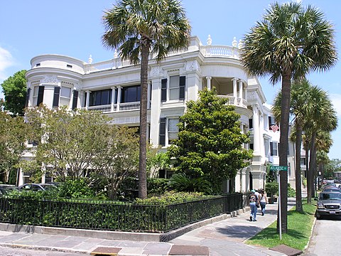
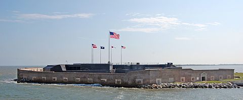
We spent a little time exploring Charleston, taking a ride downtown and along the historic shore front. It was here that we learned all about the start of the American Civil War and we spent time in one of the old mansion houses along the front, from which the Southern Generals were able to watch the very first action that started the war, the attack on Fort Sumner.


Charleston, South Carolina, was a hotbed of secession at the start of the American Civil War and an important Atlantic Ocean port city for the fledgling Confederate States of America. The first shots against the Federal government were those fired there by cadets of the Citadel to stop a ship from resupplying the Federally held Fort Sumter. Three months later, the bombardment of Fort Sumter triggered a massive call for Federal troops to put down the rebellion. Although the city and its surrounding fortifications were repeatedly targeted by the Union Army and Navy, Charleston did not fall to Federal forces until the last months of the war. Charleston was devastated.
INTRACOASTAL WATERWAY TO GRAHAM CREEK

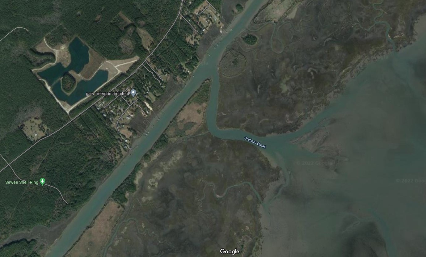
33°00'44.6"N - 079°35'21.1"W
0700 anchor lifted and headed away, with Wendreda in company, to the entrance into the Intracoastal Waterway, our destination Graham Creek some 30nms up the waterway from Charleston. 0730 Jim reports that the first bridge opens at 0900 so we could have had another hour in bed. At 0900 precisely the Ben Sawyer swing bridge opened and we passed through with no problems (in the main this was to be our experience with all bridge transits whilst we explored the Intracoastal Waterway).
This voyage up the waterway was wonderful and we were able to sail most of the way using only our Genoa.
When we arrived at the entrance to Graham Creek, we turned right into the entrance and Kiah was OK crossing a sandy bar. However, Wendreda unfortunately ran aground on the sand bar. No problem as we were able to help them get off and we subsequently spent a very peaceful night at anchor.
GEORGETOWN

33°21'51.7"N - 079°16'59.9"W
NORTH CAROLINA
.jpg)
BEAUFORT
28°02.97'N - 014°21.83'W