Having decided that we would take the river and canal route back to the Channel, rather than go back West, out of the Med and head North against the prevailing winds up the Portuguese coast and across the Bay of Biscay. Alan had to ensure he had all the licences and permissions as well as long shore lines (4 of them) and the correct navigation books and charts. All that being done, we then headed to the French Port of Sete, in the Gulf De Lion.
THE GULF DE LION
Our voyage to Sete took us into the natorious Gulf De Lion, noted for it's sometimes severe weather conditions. It seems that this is a part of the Mediterranean where North/Northwest winds can, and do sometimes, get squeezed between the Pyrenee Mountains that are the border between France and Spain, and the French Alps and race down through the Rhone valley increasing speed as a result of a 'Venturi' effect. At certain times of the year and under certain weather conditions, the result can be extremely strong gales. These gales can reach as far as the Balearic Islands as well as Corsica, Sardinia and Italy.
We had another decision to make and that was which way do we go to enter the Rivers and Canals systems. There were two options open to us, head all the way East to Port Saint Louis du Rhone or head to the closer port of Sete and take the Canal du Rhone a Sete to reach the Rhone. We decided to take the Sete route.
Please note that the Lat and Long positions given are roughly appropriate for the place or lock to which we are referring, forgive us if they are not exact.
THE FRENCH RIVERS AND CANALS
SETE
43°23.65'N - 003°43'E
Our voyages inside the Gulf de Lion were a real mixture of sailing conditions from smooth seas with good following winds to hard on the nose strong winds and heavy seas. The last leg to Sete started with difficult conditions and Kiah seemingly heading into the oncoming large waves for the first few hours. Thank goodness the conditions did moderate and we entered the very large protected harbour at Sete through the Westernmost entrance. We then crossed the outter harbour and moored alongside in Vieux Bassin, a very well sheltered marina.
Most of our time in Sete was spent in Vieux Bassin. The town itself was excellent and the people extremely friendly. We also made the most of our time in Vieux Bassin, preparing everything for our journey through the Rivers and Canals.
Arrangements had been made for us to move to a marina at a place called Navi-Bois (a Marine Broker with some marina berths whilst work is carried out on yachts). Navi-Bois is located near to the entrance to the Canal du Rhone a Sete and so it was very convenient for us and they were able to un-step Kiah's mast. I had also made arrangements for a Belgium yacht shipping company to attend us in Navi-Bois to wrap the unstepped mast and then transport it to Belgium, to be there when we arrived in Nieupoort.
CANAL DU RHONE A SETE
43°25.43'N - 003°41.78'E
The Canal Du Rhone A Sete is approximately 100 kilometers long.
The latitude and longitude of this canal, shown above, is given at the mid point between the two navigational bouys in the Etang De Thau, the Western end of the canal. Having passed into the canal heading East, we suddenly found ourselves in a new world, motoring Kiah with no mast up (we arranged a jig to cover the deck entry point of the mast, to stop rain getting into the main cabin, it worked really well, basically two pieces of strong and painted plywood, one on deck and the other on the deckhead within the main cabin. These were connected through the mast hole with a threaded stainless steel bar bolted at both ends to tighten the wood panels into place this plywood rig was then sealed with mastic around the external fittings.
This lovely canal winds its way mainly Northeast through beautiful countryside to join the mighty Rhone.
The Canal passes through the Camargue region of France, famous for its horses, pink flamingoes and half-wild bulls. We certainly saw some of the horses and flamingoes but, having to concentrate on navigation of this canal, being our first experience of canal navigation, I am afraid to say we did not take in all of the wonderul sights.
FRONTIGNAN
43°26.93'N - 003°44.62'E
Our first overnight stop. We had left Navi-Bois too late to be able to transit the bridge at Frontignan, so we had the great pleasure of mooring alongside this lovely town's jetty and spending a very peaceful night (though we had to be up early to catch the 07:30 bridge opening the next day).
Absolutely no problems the following morning and we were ready and waiting when the bridge opened. Once through we again were amazed (a feeling we never lost in the rivers and canals of France) at the wonderful views of countryside.
ST GILLIES LOCK AND PETITE RHONE
43°38.62'N - 004°25.84'E
We motored all day through the Carmarge and towards the our link with the major River Rhone. The distance from Frontignan to the St Gillies Lock being approximately 34 nms at a speed limit of just 8 knots. The St Gillies lock marks the end of the Canal du Rhone a Sete and, once through the lock we were into the Petite Rhone.
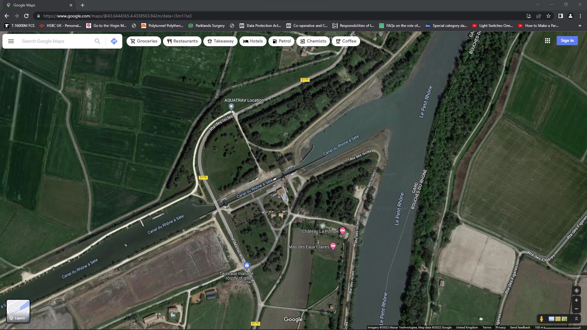
We had hoped to be able to tie up alongside a pontoon or the side of the canal once we were through the lock but we were to be a little disappointed (not for the last time) as, effectively, there is no stopping place along the 10.8 nm Petite Rhone.
THE RIVER RHONE
ARLES
43°40.83'N - 004°37.54'E
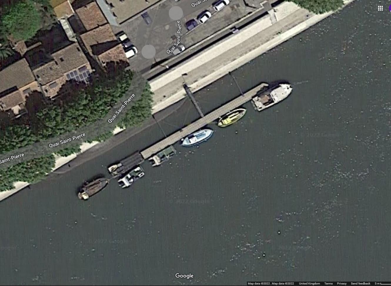
It was late afternoon when we reached the junction between the Petite Rhone and the Rhone itself. We felt it right to turn down stream and head into Arles, thinking we would be able to pick up a mooring or anchor or go alongside a marina berth. Once again we were somewhat disappointed. As the evening was drawing in we spotted a pontoon on the West side of the river, very small but with what looked as though there would be room enough for Kiah. We circled to have a good look at the berth and then started to make our way alongside (we would be right at the Southern most end of the pontoon with our stern sticking out a little but that was not thought to be a concern. As we motored up slowly, we were waved off by two French gentlemen on their boat further up the pontoon. They were kindly warning us that the depth where we had planned to go was very shallow. So we started to move off, thinking we would end up making an night passage up River to a suitable stopping point. Thankfully, the two French gentlement waved for us to come alongside their boat for the night and kindly took our lines as we slowly manouvered up to them. What a relief. I went and got the beers out and we chatted with the French guys for a while, before they then headed off to their homes, telling us not to worry we would be safe tied up to their boat.
Just a little aside to this story. Whilst we were chatting away in our pigeon French and they were doing likewise in the pigeon English, they managed to explain to us why there were 'ring bolts' some thirty or more feet up the concrete face from the river to the streets of the little town (it became clear that much of the river sides down this far were also massive structures on both sides of the river. It appears that in really heavy mountain rains (way up North) the river obviously swells but as it gets this far down stream is has been known to raise the water level all the way up to the 'ring bolts' some thirty feet above us. It also became clearer when we saw the gentlement leaving and climbing the many stairs up to a gate at the top. These two men, made us realise that this is what 'friendly' means. They had no reason to help us but they did and for no financial gain whatsoever. Wonderful.
The image below shows the actual pontoon area that we stayed alongside for the night. Click on it to see a larger 'lightbox' view
Ecluse de Vallerbregues (Beaucaire)
43°49'19.63"N - 004°38' 38.7"E
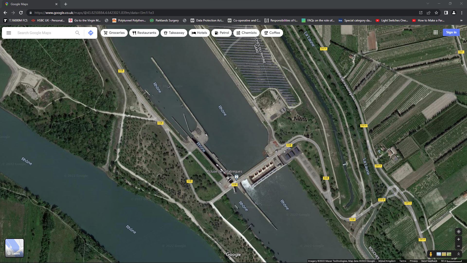
Our first lock on the River Rhone set the scene for many more such experiences. The efficiency of the French locks is second to none and in general the lock keepers are very smart and friendly people. We had understood that to call ahead to advise your intention to go up river, the word that is used is Montant, we thought that this meant as we were heading North up the River Rhone and through the canals, we must always advise that we were Kiah and MONTANT. How wrong we were as you will see when we get further into the canals.
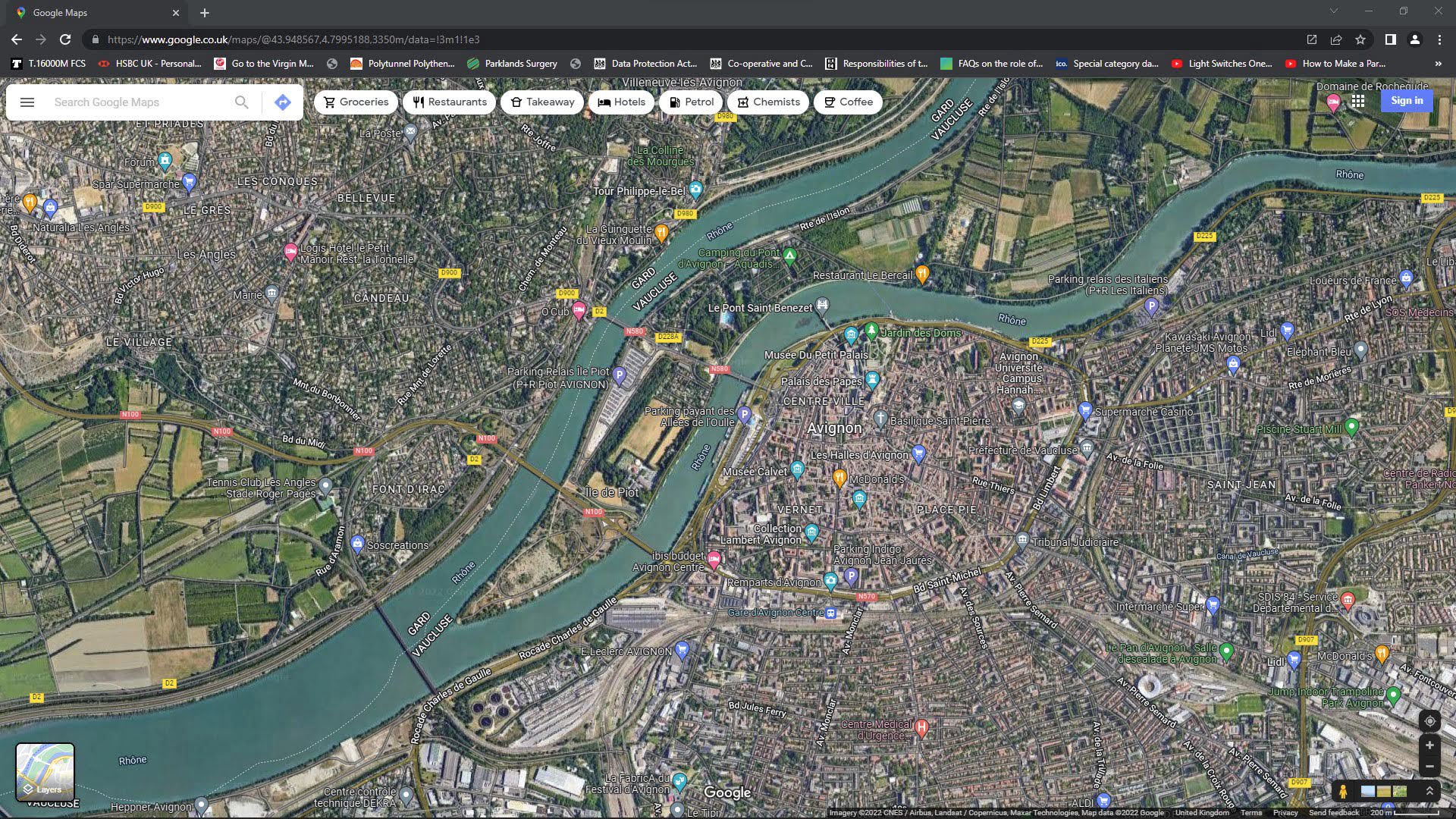
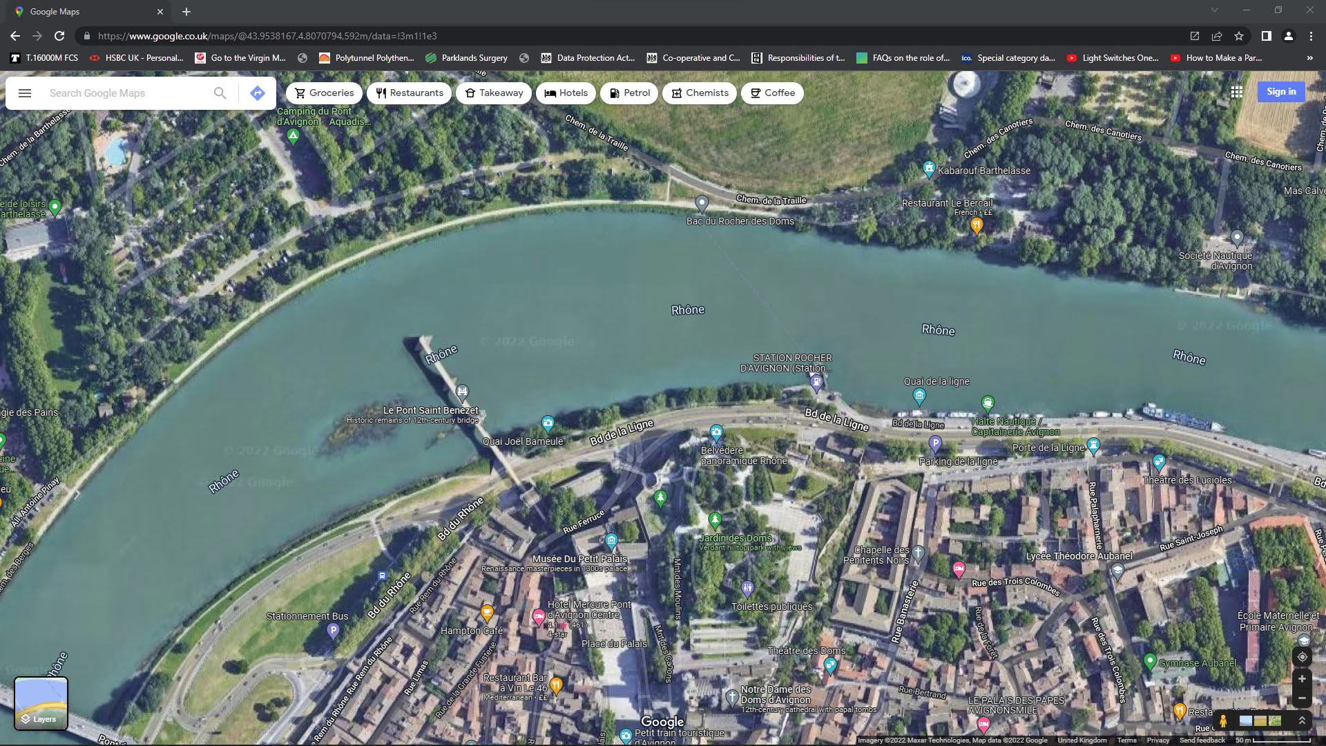
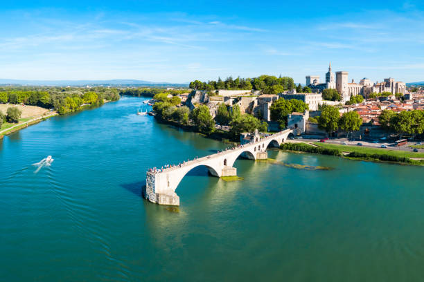
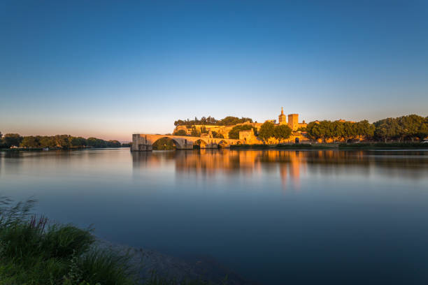
AVIGNON
43°40.83'N - 004°37.54'E
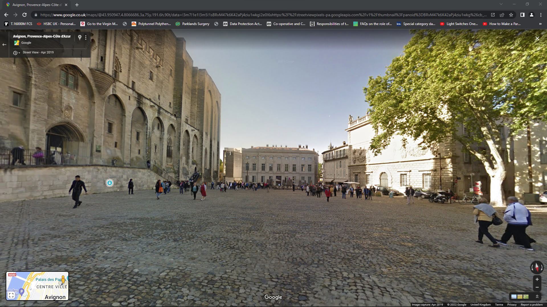
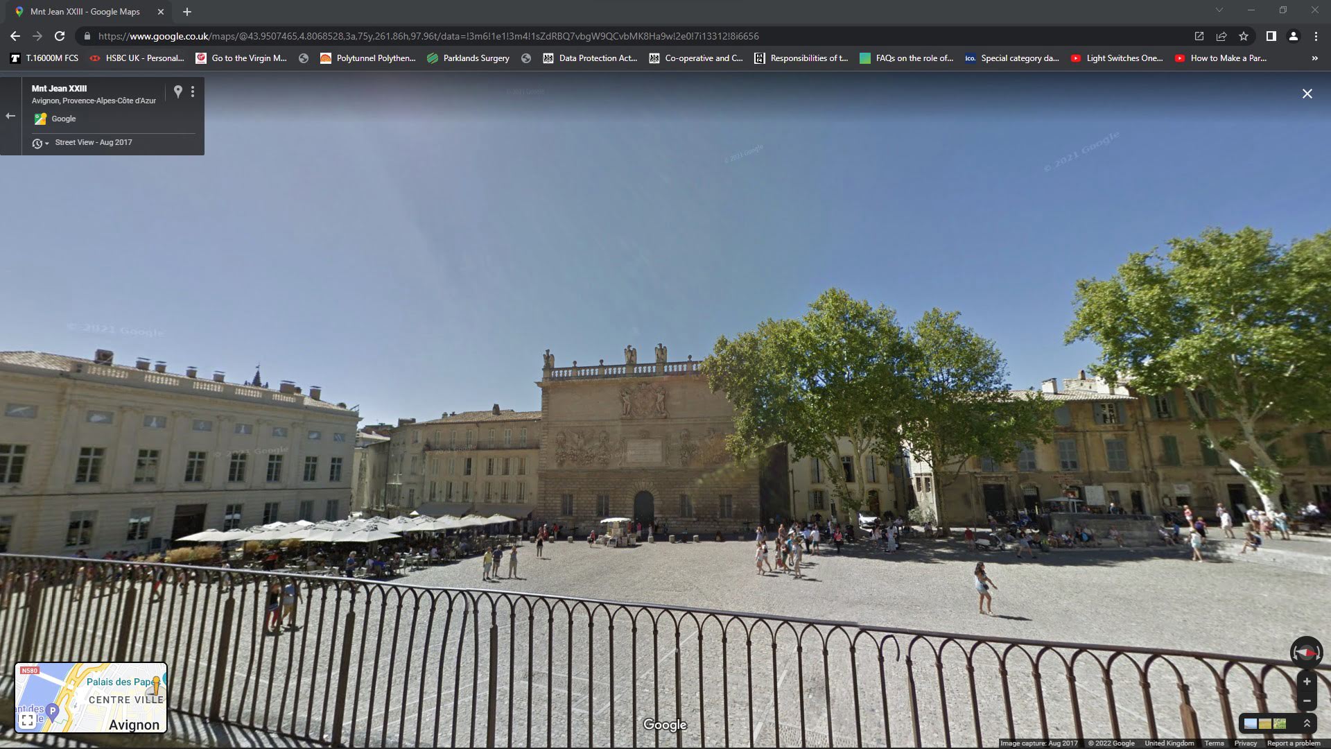
We really did not know what we were about to experience in Avignon. Like most people we had heard of the town or city but we did not know which it was 'town' or 'city', nor did we know why it is so famous. The surprise was outstanding and we had a wonderful time here exploring the old streets and seeing the many and quite spectacular sights.
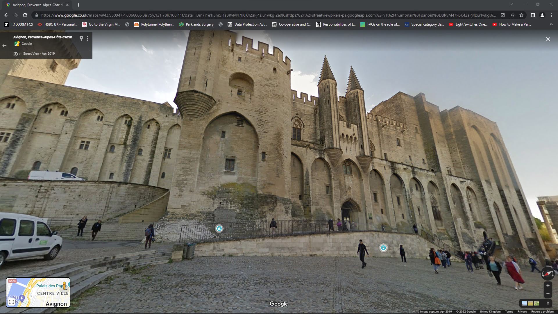
It was quite remarkable finding the Palais des Papes and hearing the story as to how it came about. You may know already but for those who do not here it is in brief, my thanks to historians who posted the items below on line.
The Palais construction began in AD 1252. Avignon became the residence of the Popes in 1309, when the Gascon Bertrand de Goth, as Pope Clement V, unwilling to face the violent chaos of Rome after his election (1305), moved the Papal Curia to Avignon during the Avignon Papacy"..
Despite its grandeur, the main focus for many of the Popes was on eventually returning to Italy. In 1376, Pope Grégoire XI managed to restore order and reestablish the Holy See back in Rome but two years later, upon his death, Palais des Papes once more came to prominence. A new Italian Pope, Urban VI, was elected in Rome while opposing cardinals elected another pope, Clement VII, to rule from Avignon. The palace came to symbolize the rift in the Catholic Church.
THE BELGIUM CANALS
INTO BELGIUM TO NIEUPOORT